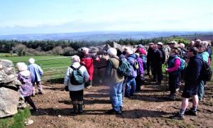
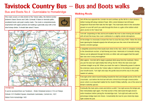
Walking in the Tamar Valley
For more information on Walking in the Tamar Valley, please visit https://www.tamarvalley-nl.org.uk/discover-explore/walking/
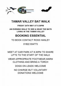
Bat Walks
For more information on the Bat Project, please visit http://devonbatproject.org/
Local Area Walks
CALSTOCK FOOTPATH SOCIETY
The Society works alongside the Parish Council to ensure that the footpath network is checked at least three times a year to make certain that use is not denied. They also organise regular walks.
Website: http://cfs.btck.co.uk/
Email: calstockfootpath@gmail.com
Tamar Trails
There are over 25km of walking trails for you to explore from the Tamar Trails Centre. These hiking trails will lead you through the woods to breathtaking views of the Tamar valley and a landscape shaped by the area’s mining heritage. Situated between Tavistock and Callington on the Devon Cornwall border, the walking trails are here for everyone to enjoy.
Website: http://www.tamartrails.co.uk/walking/
Devon Public Rights of Way – Devon County Council
https://dcc.maps.arcgis.com/apps/webappviewer/index.html?id=e1bcf0f17e0a4b898fb878bb9a55fb7d
Public Rights of Way Interactive Mapping – Cornwall Council
From 17 January 2018 Cornwall Council have decided to adopt and implement the notation as defined in Schedule 1 of Regulation 3 of ‘The Wildlife and Countryside (Definitive Maps and Statements) Regulations 1993’ and added to by ‘Advice Note No 22’ from the Rights of Way Section of The Planning Inspectorate (with regard to the notation for restricted byway), such that:
- Footpaths – magenta, (purple) solid line
- Bridleways – green, solid line
- Byways – brown, solid line
- Restricted Byways – green, broken line
Click on the link below to view the interactive map, this shows all public rights of way throughout Cornwall.
Public Rights of Way interactive map
You can also find the locations of schools, leisure centres, libraries, household waste recycling centres, salting routes, safety cameras and many other layers throughout Cornwall. You can zoom to a specific area by entering a location i.e. towns and villages, street or postcode, in the search box on the map.
I Walk Cornwall
The below content is provided by https://www.iwalkcornwall.co.uk, clicking on the below links will open a new window and direct you to the above website.